Click on any of the following map thumbnails to view a high-resolution version.
Bond, Watertown, Great Dividends of 1636
Nylander, Boston Post Road 1775

Nylander, Boston Post Road 1783
Kingsbury, Weston 1794-96

Hales, Boston & Vicinity 1820
Tower, Weston 1830
Sidney, Boston & Vicinity 1852 [aka "Craigie" map]
Walling, Middlesex County 1856
Walling, Boston & Environs 1866
Lake, Boston & Environs 1867
Atlas of Middlesex County 1875
Atlas of Middlesex County 1889
Atlas of Middlesex County 1908 (Weston, Plate 12)
Atlas of Middlesex County 1908 (Weston, Plate 13)

Town Square 1911
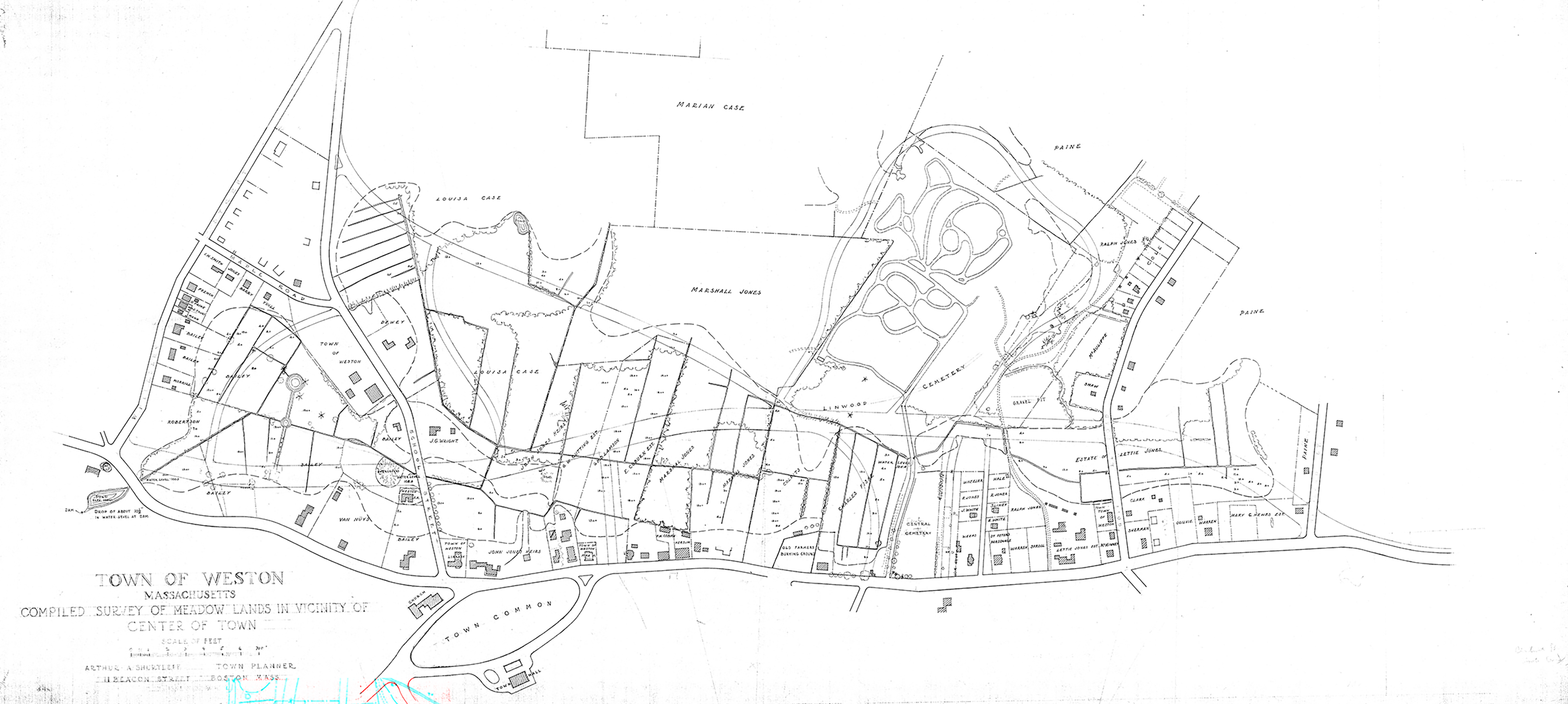
Meadowlands in Vicinity of Town Square, mid-1920s
Map Descriptions
Information on digital versions of Weston maps courtesy of Cindy Bates, who compiled an extensive map list for her upcoming book Uncovered: The History and Mystery of the Melone Homestead, 27 Crescent Street, Weston, Massachusetts.
Sources for online versions: Norman B. Leventhal Map & Education Center at the Boston Public Library; Library of Congress; Lionel Pincus and Princess Firyal Map Division, The New York Public Library Digital Collections.
Bond, Watertown, Great Dividends of 1636
Weston was originally part of the Watertown Settlement of 1630. This map illustrates the diagonal squadron lines marking the first division of land in Watertown in 1636. From Bond, Henry. "1st Map Illustrating the Relative Position and Boundaries [of Watertown]," 1855, in Genealogies of the Families and Descendants of the Early Settlers of Watertown, Massachusetts, including Waltham and Weston, 2nd ed, Boston, New England Historic Genealogical Society, 1860, facing p. 985.
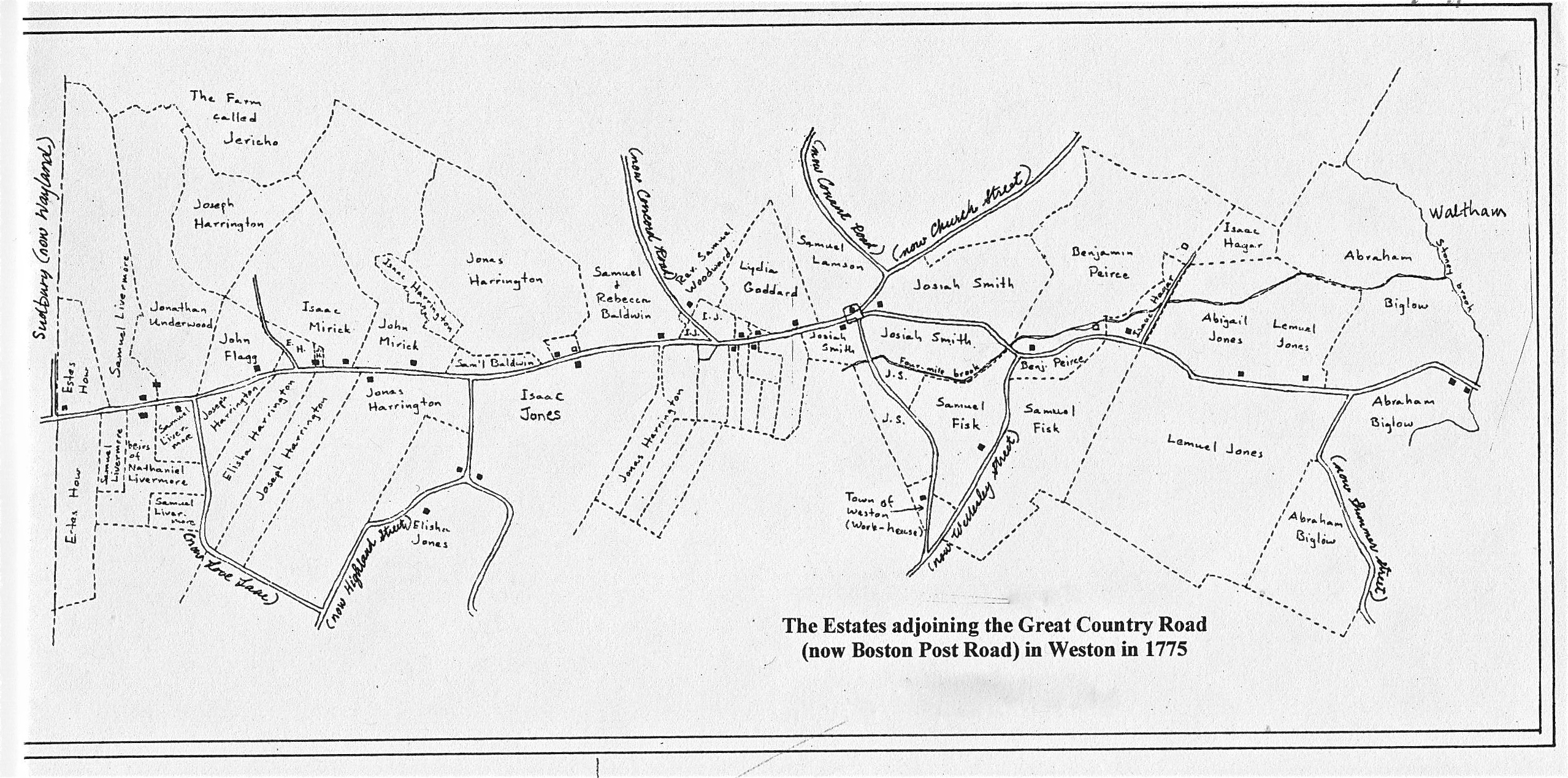
Nylander, Boston Post Road 1775
"The Estates adjoining the Great Country Road (now Boston Post Road) in Weston in 1775," researched and drawn by Robert H. Nylander for the Weston Historical Commission, 1974.
Nylander, Boston Post Road 1783
"The Estates adjoining the Great Country Road (now Boston Post Road) in Weston in 1783," researched and drawn by Robert H. Nylander for the Weston Historical Commission, 1974.
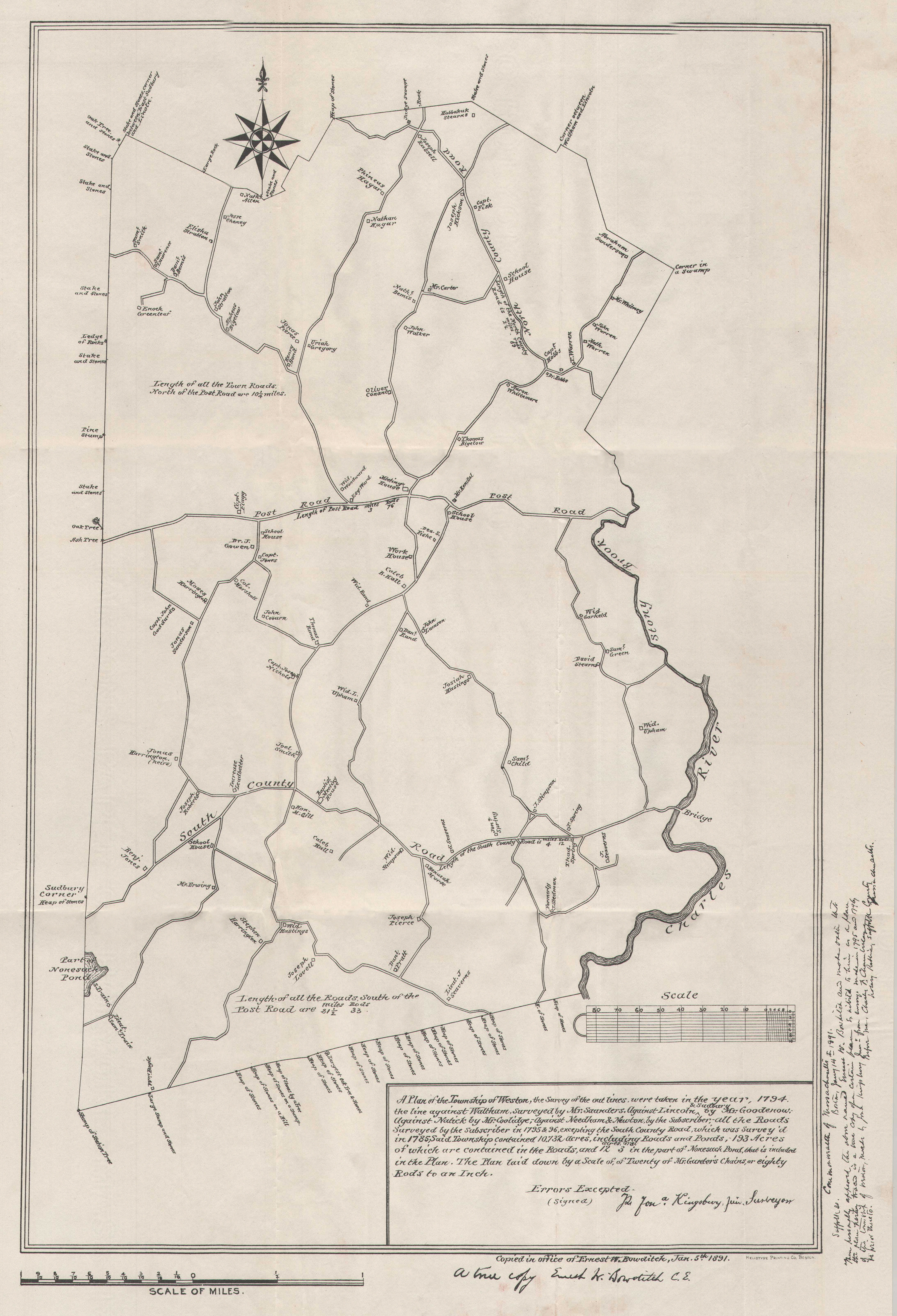
Kingsbury, Weston 1794-96
The Kingsbury Map was drawn by Jonathan Kingsbury Jr. from surveys made in 1785, 1794, 1795, and 1796. It was copied in the office of Ernest W. Bowditch in 1891 and distributed with the Weston Town Report of that year. The map does not include many houses known to have existed at that time along Boston Post Road.
Hales, Boston & Vicinity 1820
Map of Boston and Its Vicinity from Actual Survey by John G. Hales [several versions: 1819, 1820, 1829, 1833] Shown here is 1820 version. Courtesy Norman B. Leventhal Map & Education Center at the Boston Public Library, digital version of full map.
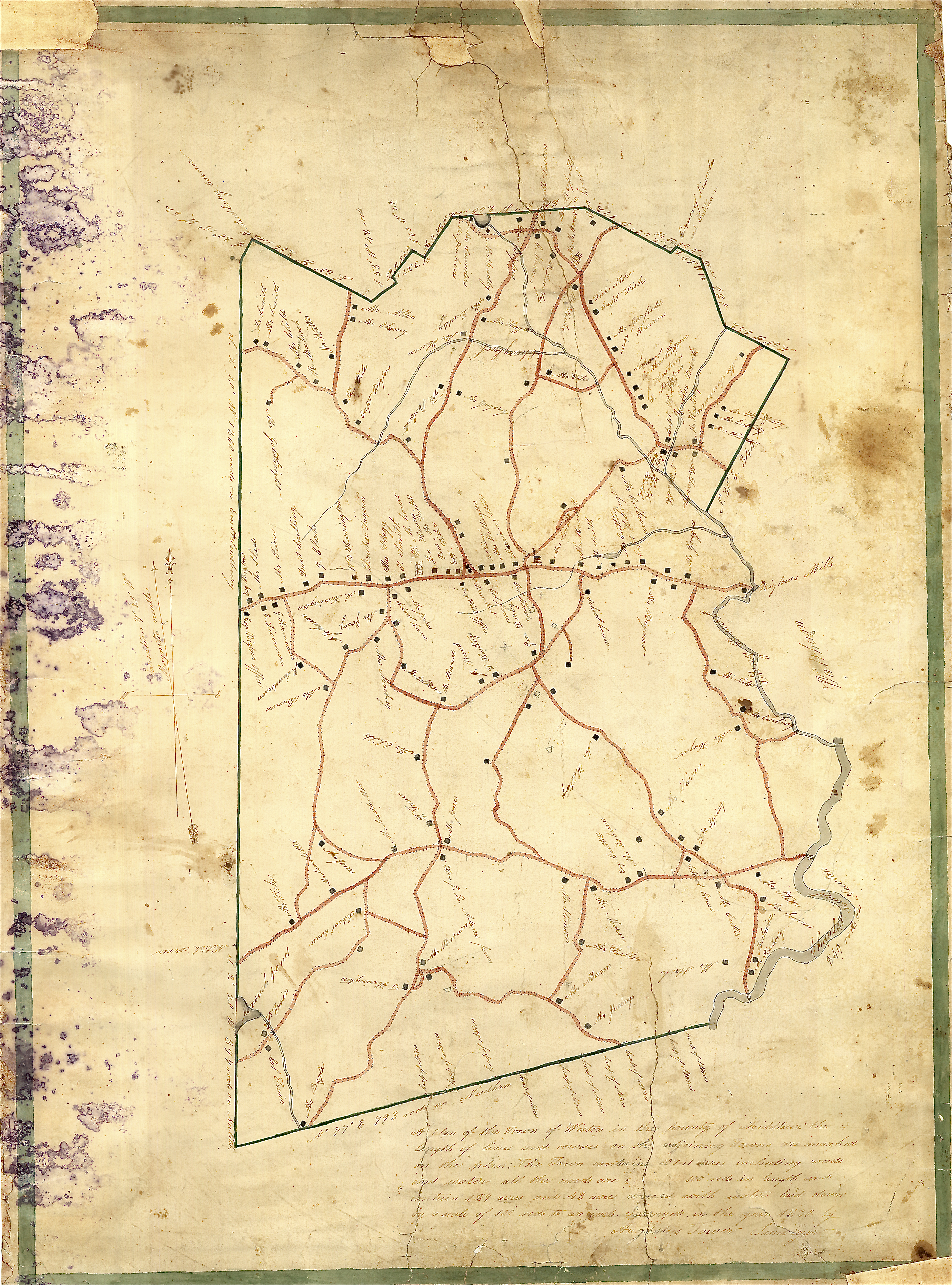
Tower, Weston 1830
A Plan of the Town of Weston by Augustus Tower, 1830.
Sidney, Boston & Vicinity 1852 [aka "Craigie Map"]
Sidney, F. G.. Detail from Map of the City and Vicinity of Boston, Mass, from original surveys by F.G. [sic] Sidney, by James G. Sidney, 1852. Courtesy Norman B. Leventhal Map & Education Center at the Boston Public Library, digital version of full map.
Walling, Middlesex County 1856
Detail from Map of Middlesex County, Massachusetts. Based upon the Trigonometrical Survey of the State, the Details from Original Surveys under the direction of Henry F. Walling, supt. of the state map, Thos. W. Baker, draughtsman, Boston, 1856. Courtesy Library of Congress, digital version of full map
Walling, Boston & Environs 1866
Detail from Map of the City of Boston and its Environs. New York: Baker & Tilden, 1866. Courtesy Norman B. Leventhal Map & Eduction Center at the Boston Public Library, digital version of full map
Lake, Boston & Environs 1867
Lake, D. J., and Worley & Bracher. "Map of the city of Boston and its environs." 1867, from actual surveys and drawn by D.J. Lake, engraved by Worley & Bracher. Courtesy Lionel Pincus and Princess Firyal Map Division, The New York Public Library, digital version of full map
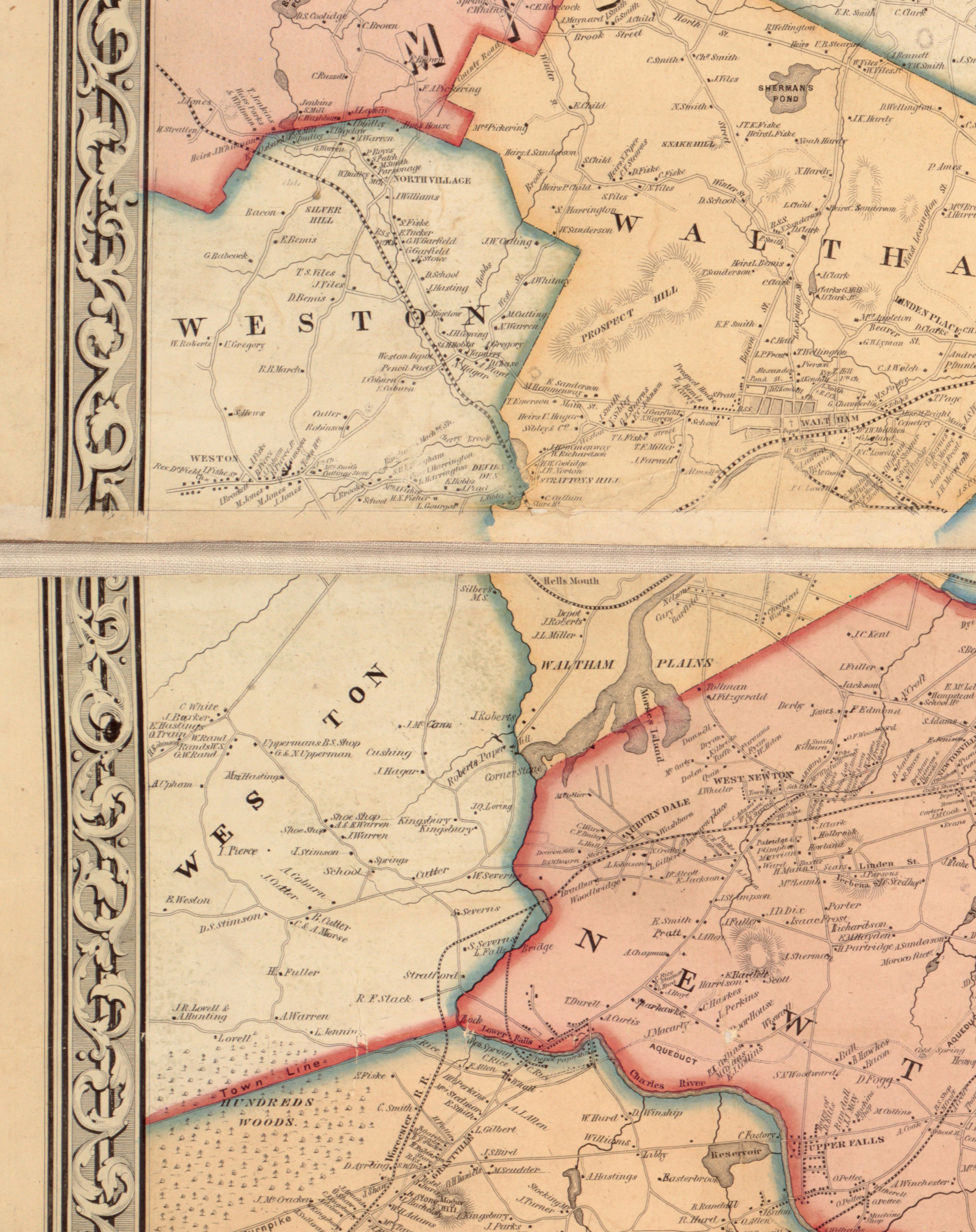
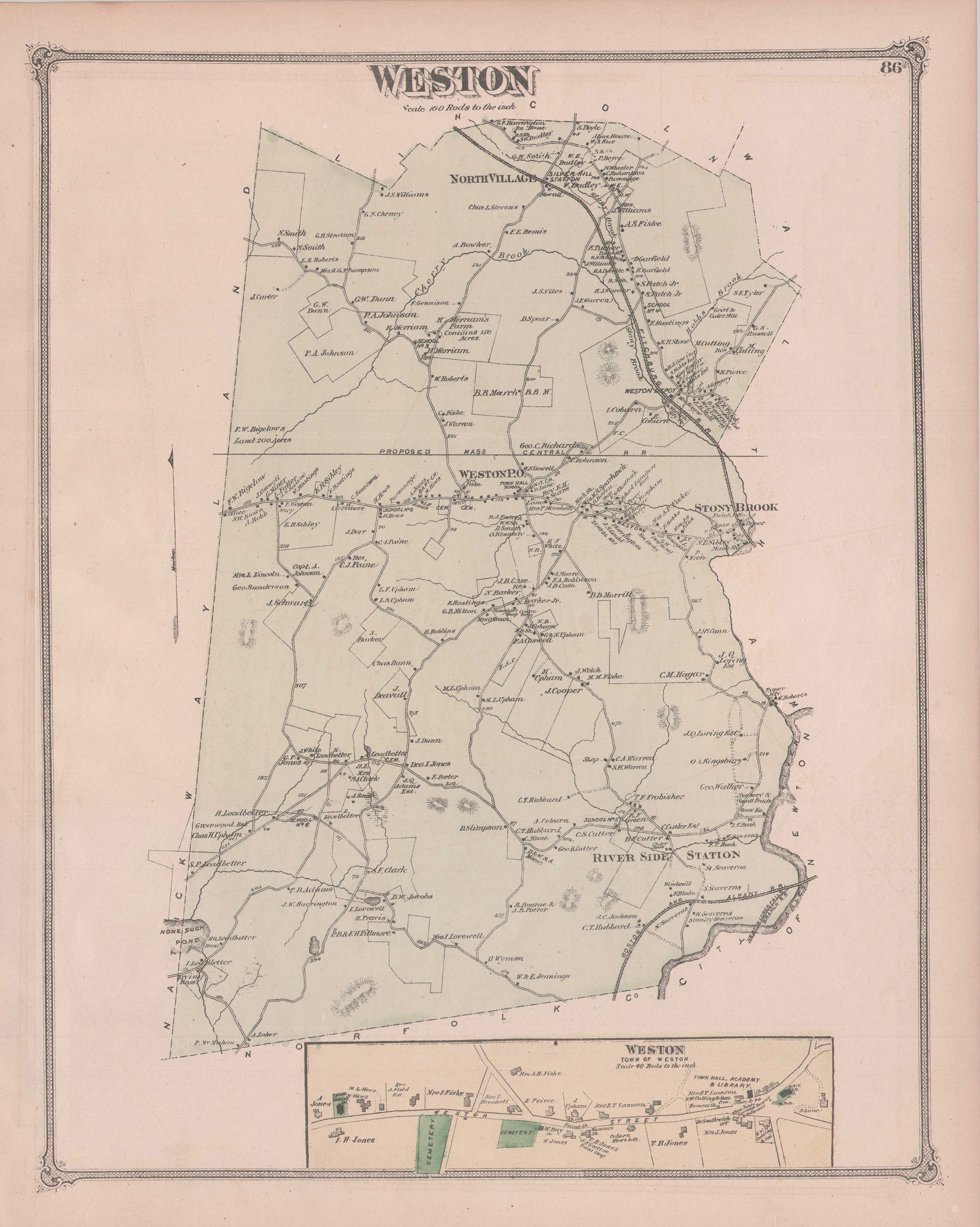
Atlas of Middlesex County 1875
Map of Weston in County Atlas of Middlesex, Massachusetts. Newton: J. B. Beers & Co, 1875 (Weston Historical Society)
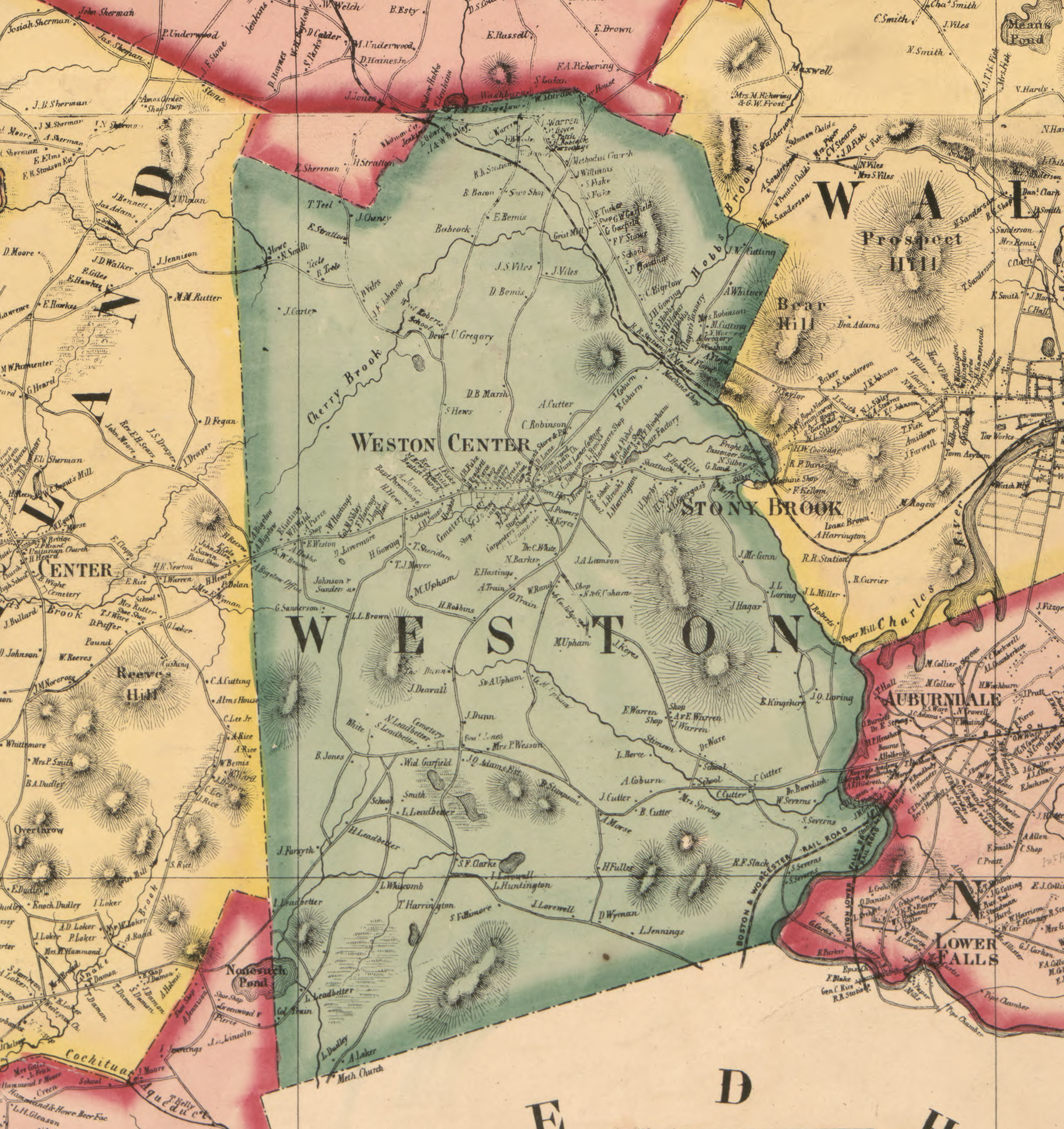
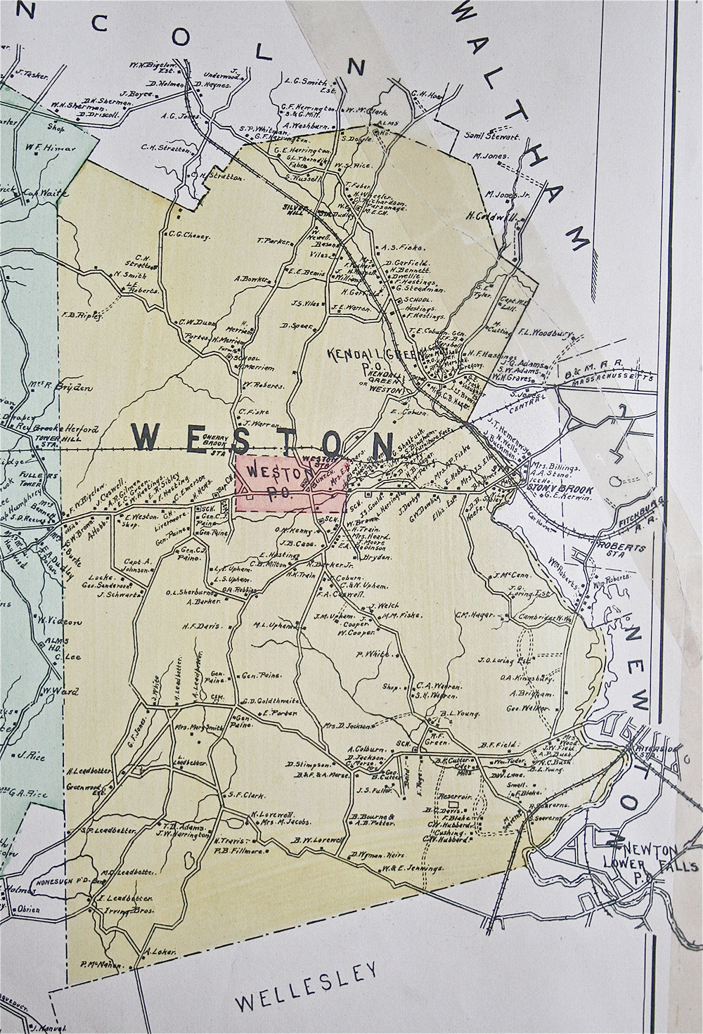
Atlas of Middlesex County 1889
Map of Weston in Atlas of Middlesex County, Massachusetts. Boston: George H. Walker & Co, 1889 (Weston Historical Society)
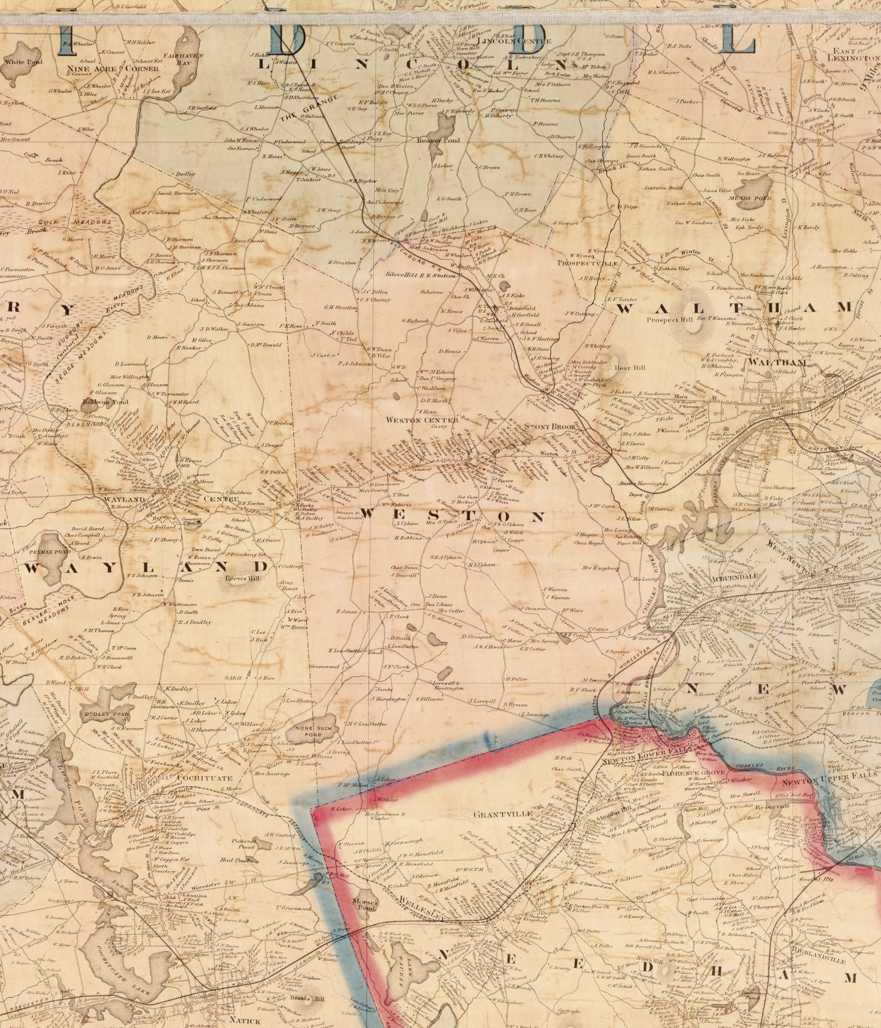
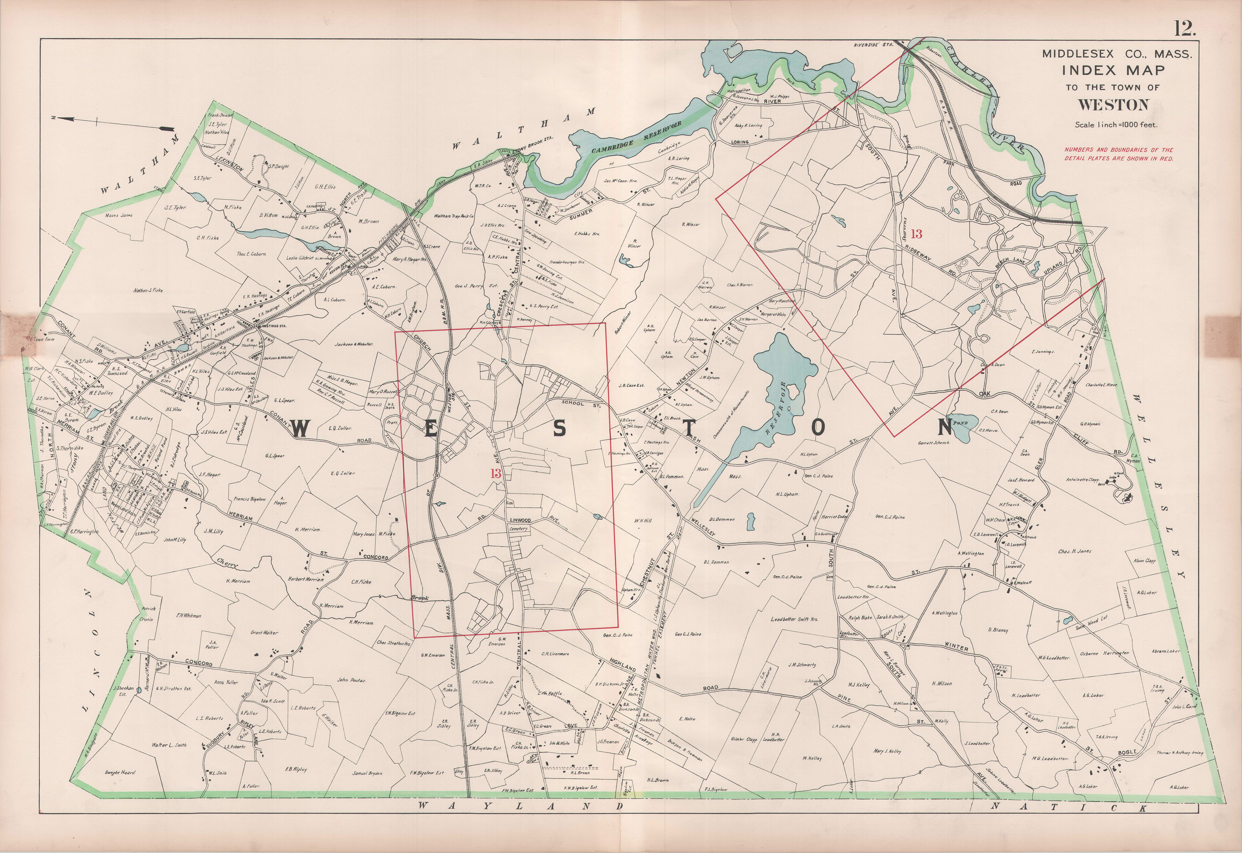
Atlas of Middlesex County 1908 (Weston Plate 12)
Map of Weston in Atlas of Middlesex County, Vol. 3. Boston, George H. Walker & Co, 1908. (Weston Historical Society)
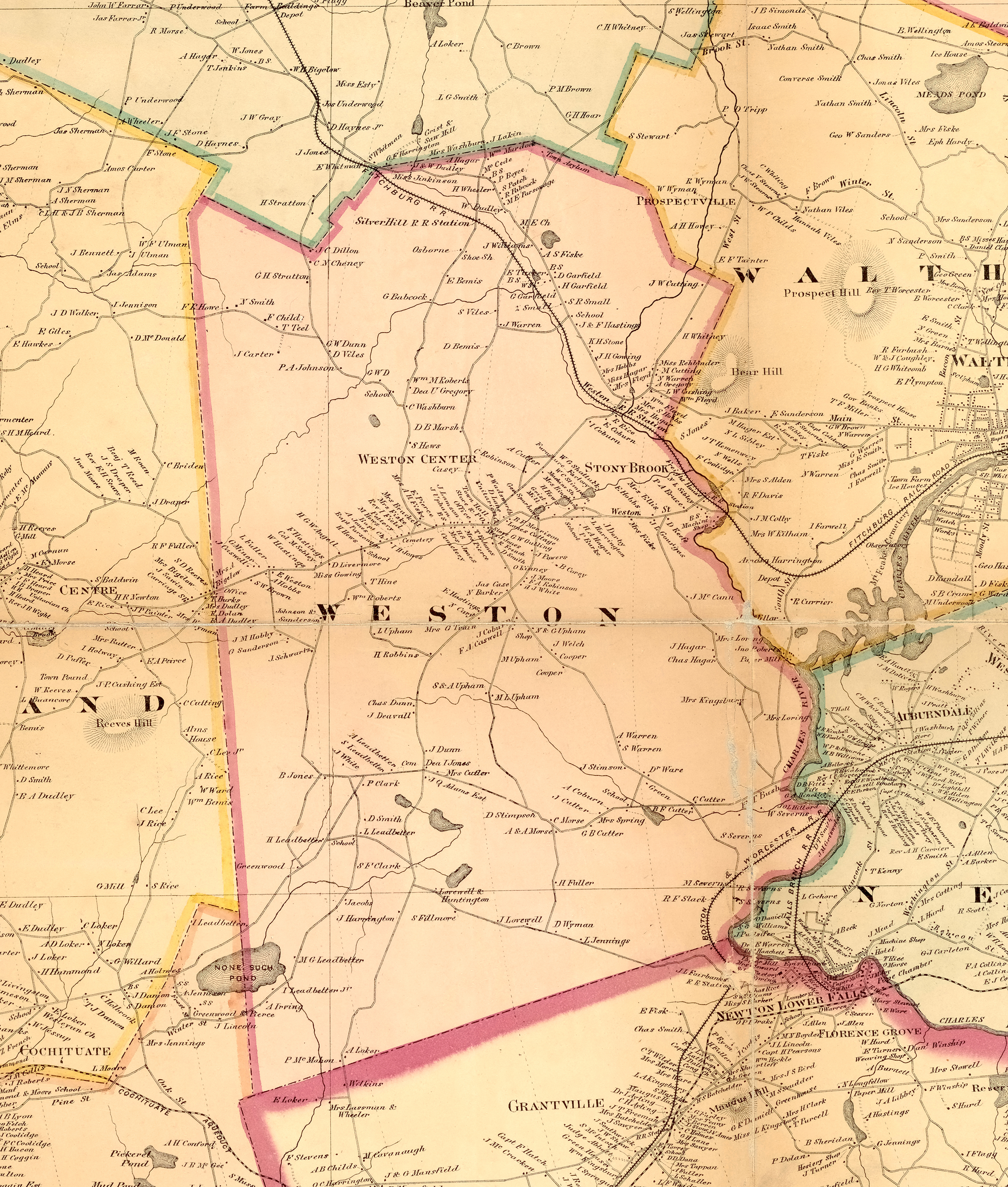
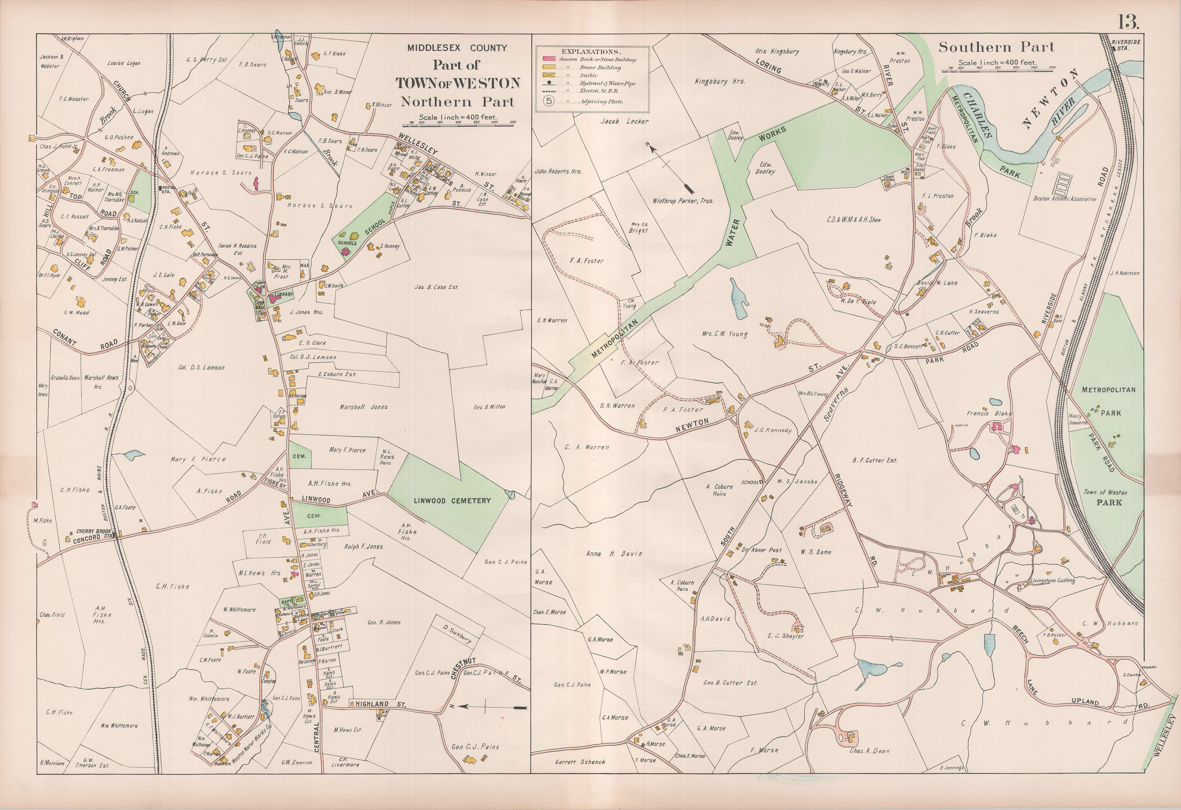
Atlas of Middlesex County 1908 (Weston Plate 13)
Detail of town center and south side from Plate 12. (Weston Historical Society)
Town Square 1911
Vicinity of the Town Square, Weston, Mass. In 1911, Weston's Committee on the Improvement of the Center of Town prepared a circular sent to each household, including this map of the "town square" and a message urging citizens to submit their suggestions. (Weston Historical Society)
Shurtleff, Meadowlands in Vicinty of Town Square, mid-1920s
Town of Weston Massachusetts, Compiled survey of Meadow Lands in Vicinity of Center of Town, Arthur Shutleff, Town Planner. Shurtleff (later Shurcliff), in his position as a consultant to the Weston Planning Board, laid out the route of the present State Road By-Pass, constructed in the early 1930s. (Weston Historical Society)